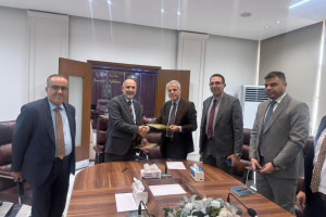
The doctoral dissertation of researcher Sahar Munther Rasen was discussed at the College of Engineering, University of Basra, Department of Civil Engineering, under the supervision of Professor Dr. Abdul Hussein Abdul Karim Abbas and Professor Dr. Zuhal Abdul Hadi Hamza, entitled Investigation of the Best Potential Sites for Reservoirs and Dams Suitable for Water Harvesting in theCentral region of Iraq
Rainfall harvesting techniques are an effective tool, for mitigating water scarcity and flood risks by collecting and storing rainfall for utilization during arid intervals. These technologies enhance water security, safeguard natural resources, and advance long term development within areas susceptible to changing climates, such as Iraq. This study aims to identify suitable regions for rainwater harvesting (RWH) and appropriate zones for dam construction employing geographical instruction system, (ArcGIS) 10.8, remote sensing, and multi-criteria analysis techniques, combined with watershed modeling system (WMS) 11.1 to calculate surface runoff and choose a suitable locations for the construction of RWH dams.
Rainfall data from 1981 to 2022 were utilized to determine depths of runoff for return periods from 5 to 100 years employing HEC-HMS. The Soil ServiceConservation Curve Number (SCS-CN) approach was employed to ascertain the less rate, and the runoff rate is simulated by the SCS unit hydrograph method
Eleven criteria were identified: stream order (7th, 6th, and 5th), runoff, slope, rainfall, land cover, soil type, evapotranspiration, population centers and roads. These criteria were selected based on socioeconomic, hydrological, climatic and biophysical parameters. These served as essential input criteria, for applying the Analytical Hierarchy Process (AHP) and Weighted Liner Combination(WLC) techniques to determine the optimal locations for RWH within area of study. The suitability maps have been divided to five categories, varying between extremely low to extremely high.
The results of hydrological simulation demonstrated that total surface runoff was 15.46 BCM for return term of 5 years, then rising to 32.24 BCM for a return period of 100 years. The findings presented illustrate the significant potential of rainwater harvesting; as a strategic approach, to alleviating the region' water scarcity.
The study investigated 47 prospective locations, for constructing water harvesting dams.. These locations can be jointly extract approximately, 1953 Mm3. The percentage of water collected relative to total available of runoff with return duration from 13% at return period 5years, to 6% for 100 years return term.
According to results, the HEC-HMS model is well calibrated, as evidenced by a RMSE Root Mean Squared Error of 0.6, Nash Sutcliffe Efficiency (NSE) of 0.681 and Percent Bias (PBAIS) of -3.72%. These outcomes, indicated good concordance between simulated and actual values verifying the model's ability to explain the hydrological behaviors, and confirming that the model calibration is accurate and reliable for hydrological forecasting in the analyzed basins.
Important News


viewed most